revenue.kerala.gov.in : ReLIS Land Information System
Organisation : Kerala Revenue Department
Facility Name : ReLIS Revenue Land Information System
Applicable State/UT : Kerala
Website : https://www.revenue.kerala.gov.in/
| Want to ask a question / comment on this post? Go to bottom of this page. |
|---|
What is Revenue Land Information System?
ReLIS is a web application devised by Revenue department for enabling online integration with Registration and Survey departments thereby creating an electronically enabled backbone for the effective management of land records in the state. The project was initiated in 2011 and it was revamped in 2015 in order for better integration with all the stakeholder departments.
Related / Similar Facility : Kerala Integrated Revenue e-Payment System

How To Login To Kerala Revenue Land Information System?
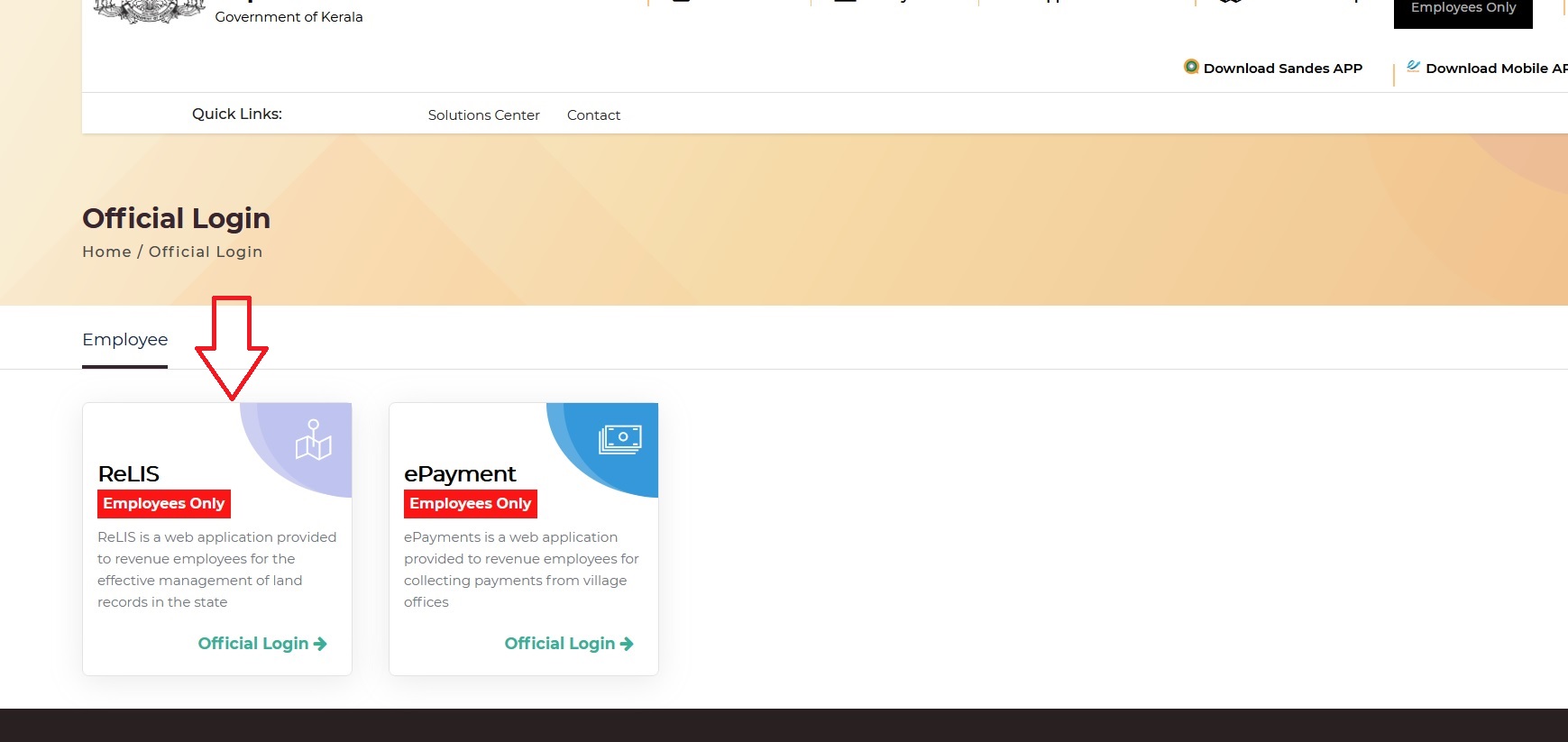
To Log into Kerala Revenue Land Information System, Follow the below steps
Step-1 : Go to the website of Kerala Revenue Department
Step-2 : Click on the link “Official Login” (Employees Only)
Step-3 : Then Click on ReLIS Tab
Step-4 : Enter your Username, Password and Captcha
Step-5 : Click on “Sign In” button
Kerala Revenue eServices
Land Revenue is a department having a great reach in the routine life of citizen – be it payment of statutory taxes and fees, getting certificates for various purposes, tackling emergencies and the like. Integrating all the services in a common platform is the need of the hour especially in the pandemic scenario where citizen are forced to confine in their households for longer periods.
The Web application is designed to avail revenue services by enjoying the comfort of home. The main highlight of the application is that it is mobile friendly. Citizen can avail the services by registering in the portal. The history of the remittances are digitally saved in the individual logins for future reference avoiding the burden of keeping hardcopies of the same.
By this endeavor, department is planning to move into a completely IT enabled service delivery system targeting maximum benefit to the citizen. One small step for the citizen and one giant leap for the department
e-Maps:
Web Application designed for integrating textual data with Spatial Data in order to obtain a purified land records maintenance system adhering to maximum ground truthing. The integrated eMaps Application will be a tool for the effective management of land records, minimize scope of land disputes, enhance transparency in the land records maintenance system, and facilitate the goal of guaranteed conclusive title to land.
The scope of the system comprises an end to end solution for cadastral mapping, starting from digital verification of raster and vector data of cadastral maps, conducting digital survey, its integration with Textual Data and services such as mutation, updation, distribution of Land Records and maps in G2G and G2C domain as envisaged in the objectives of DILRMP project. The web application will incorporate all organization work flows and procedures followed in the Department.
In present scope of work, cadastral maps are prepared within village boundaries with proper village index defining association and direction and orientation among plots constituting the village. The Citizen will be able to get the updated Digital Sketch of every single parcel in the village.
Contact
State IT Cell-Revenue
Public Office Buildings,
Trivandrum, Kerala, India.
Phone : 8547610009
Email : stateitcell AT gmail.com